Four thousand metres,
and everything follows
Barley ripens at the altitude where wheat will not. That single fact sets the staple, the herd, the fuel, the tent and the wall.
The plateau averages more than four thousand metres. Everything grown, worked or built on it is an answer to that one number.
- 01 The stapleBarley ripens where wheat fails; roasted and ground it becomes flour that needs no cooking.Tsampa
- 02 The workOne animal carries the load, the milk, the wool and the fuel.The Yak
- 03 The wallNo frame, little timber: mass walls laid thick and leaned inward.Battered Walls
Six sections carry it: land, then the work done on it, then the record of both.
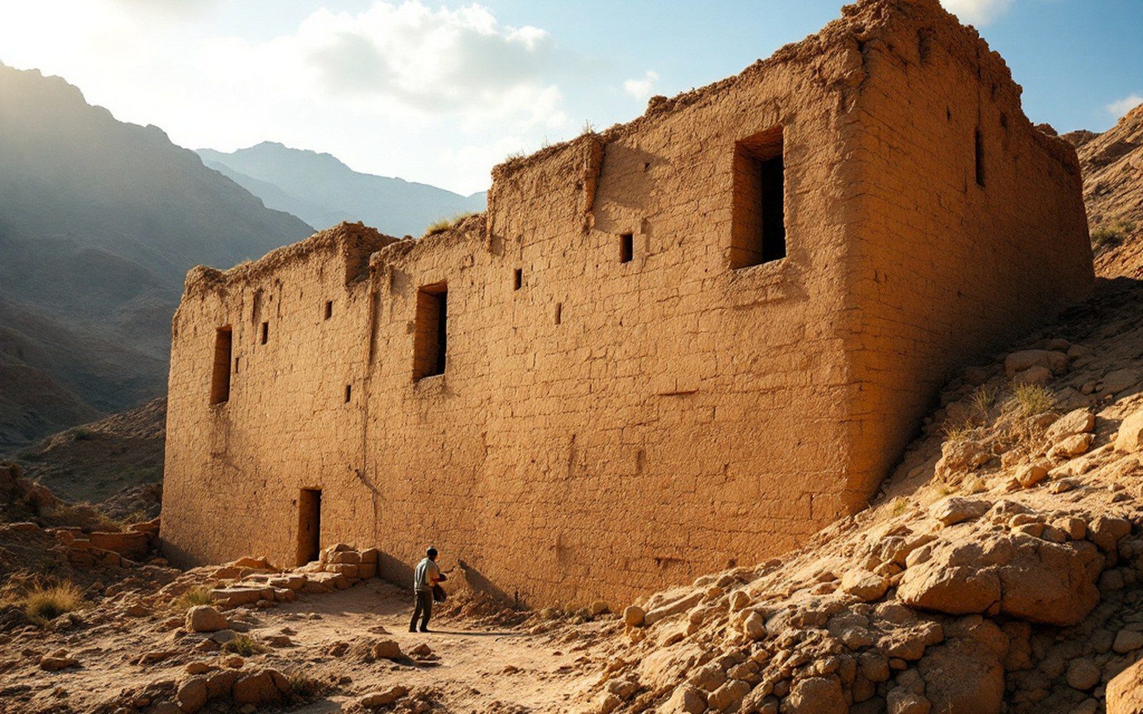
The inward lean is structural: a thick base narrowing as it rises keeps a mass wall standing without a frame.ProTibet picture library
Farming stops where herding starts
Above roughly four thousand metres the valley floors carry barley and little else. Higher and drier, on the Chang Tang, there is no cultivation at all — only grass, and animals moved across it.
The Barley Line · Lakes of the Chang TangRead it in four
The shortest route through the site: one animal, one crop, one wall, one survey. Everything else hangs off these.
Or take all twenty-four Barley and Yak
The Yak
Start with the animal that made the plateau habitable above the barley line.
02 Barley and Yak
Tsampa
Then the crop it shares the ground with, roasted so the flour keeps and travels.
03 Earth and Stone
Battered Walls
What the same altitude does to a wall: thick at the base, leaning inward as it rises.
04 Mapping
Nain Singh Rawat
And how the whole of it was measured — on foot, in counted paces.
The six sections
Land first, then the work done on it, then the record of both.
All twenty-four entries 02
Barley and Yak
02
Barley and Yak
Barley and Yak
What can be grown and what can carry it.
- 02.1The Barley Line
- 02.2Tsampa
- 02.3The Yak
- 02.4Black Tents
- 02.5Salt and Wool
03
Earth and Stone
Earth and Stone
Building where there is little timber and less rain.
- 03.1Rammed Earth
- 03.2Battered Walls
- 03.3Roofs and Timber
- 03.4Towers and Dzongs
 04
Pigment and Cloth
04
Pigment and Cloth
Pigment and Cloth
Colour, cloth and the measured grid.
- 04.1Mineral Pigments
- 04.2The Measured Grid
- 04.3Weaving
- 04.4Woodblock and Paper
 05
Writing
05
Writing
Writing
A script, and what survived on paper.
- 05.1The Script
- 05.2Cave 17 at Dunhuang
- 05.3Old Tibetan
- 05.4Paper and Ink
 06
Mapping
06
Mapping
Mapping
How the country got onto a map.
- 06.1The Pundits
- 06.2Nain Singh Rawat
- 06.3Instruments
- 06.4Heights and Coordinates

The colours are stones before they are paint — azurite, malachite, cinnabar and orpiment, ground and bound in hide glue.ProTibet picture library
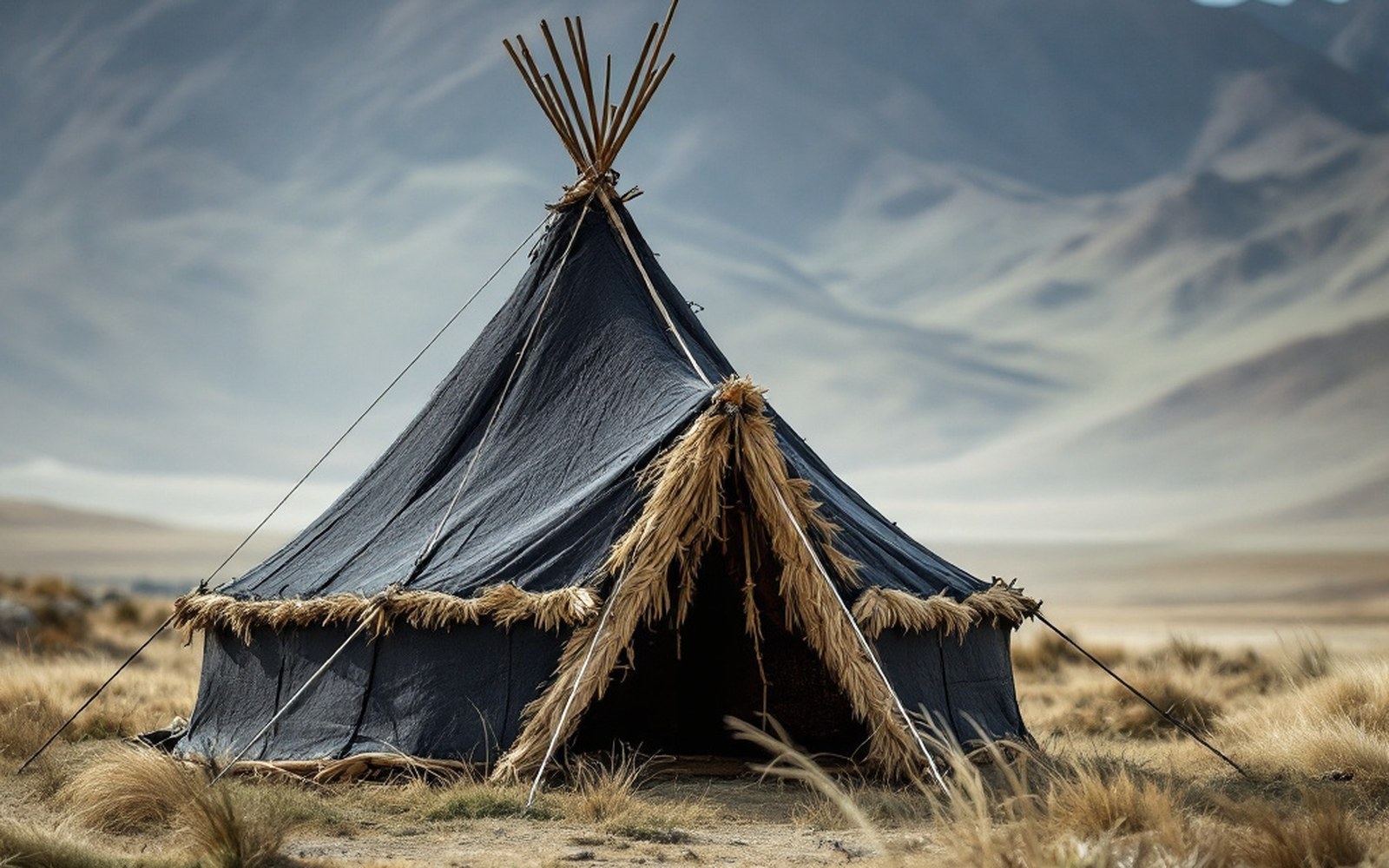
Yak-hair cloth swells when wet and closes its own weave, so a loose fabric becomes a rainproof roof.ProTibet picture library
Named on the plateau
Positions as fixed by route survey- A place an entry names — the pin opens that entry
- Graticule at 5° of longitude, 3° of latitude
- National outlines: China, India, Nepal, Bhutan
- Lhasa 29.65°N/91.12°E 05
- Gyantse 28.91°N/89.60°E 03
- Dunhuang 40.04°N/94.80°E 05
- Namtso 30.70°N/90.55°E 01
- Manasarovar 30.65°N/81.45°E 01
- Kailash 31.07°N/81.31°E 01
Geometry and pin positions from the site's own map kit.